Problem displaying GPS track
If you encounter a problem when importing the GPS track, this tutorial will help you load it correctly.
The GPS file provided with the guide consists of several tracks, one for each day’s stage (a track is a line representing the path to follow) and dozens of waypoints (a waypoint is a point indicating a location: a pass, a refuge, etc.). This file contains a wealth of information and is both accurate and complex. It is not a file containing just one track, as is often the case with those found on the internet.
Please note:
- The track you received is complete; there is no bug. The problem lies with the display or import in the application/terminal.
- You need to import the .GPX file (the .KMZ file is intended to be read with the free software Google Earth).
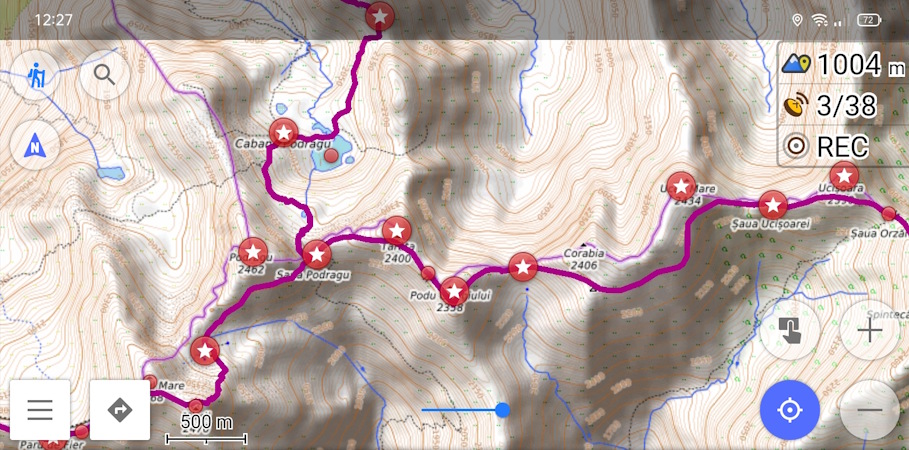
- You can view the GPS track online for each of the guides to check its contents (example here with the Făgăraş Mountainsin Romania).
The most common problem is that only one track is displayed, usually the first stage of the trek. The other tracks, and sometimes the waypoints, do not appear.
Display setting problem
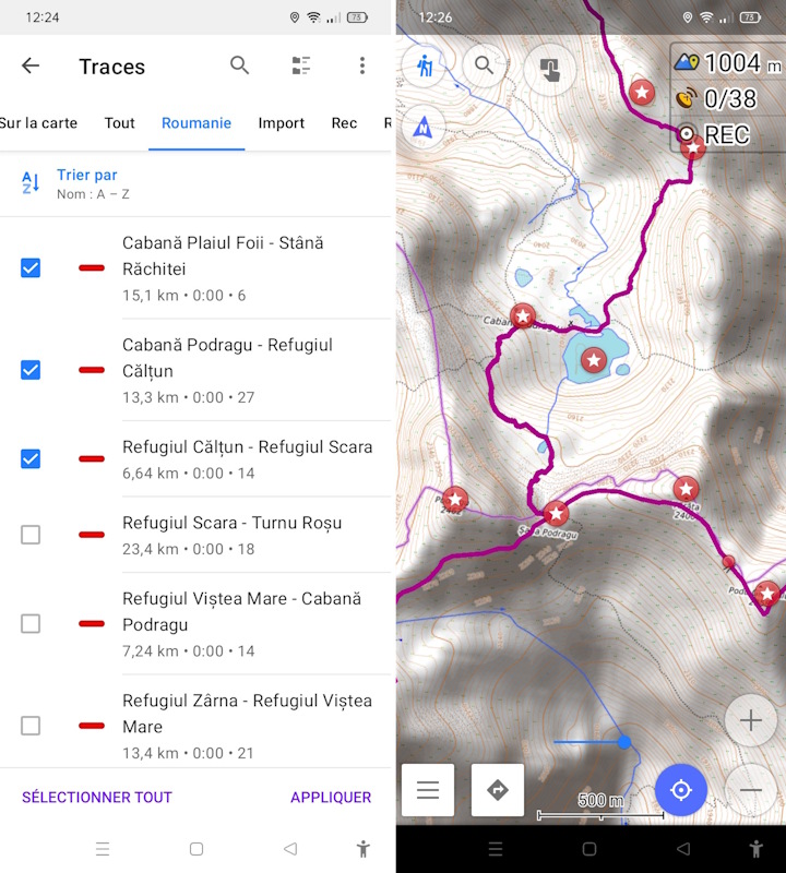
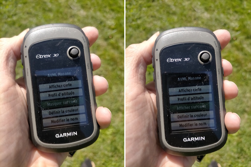
With some hiking GPS devices (Garmin, TwoNav, GlobeXplorer) and some GPS applications for mobile phones, after importing the tracks, you need to go to the settings. In track management, you need to activate the track(s) you want to see on the screen. By default, they sometimes remain hidden in order to lighten the screen display.
Problem importing the file
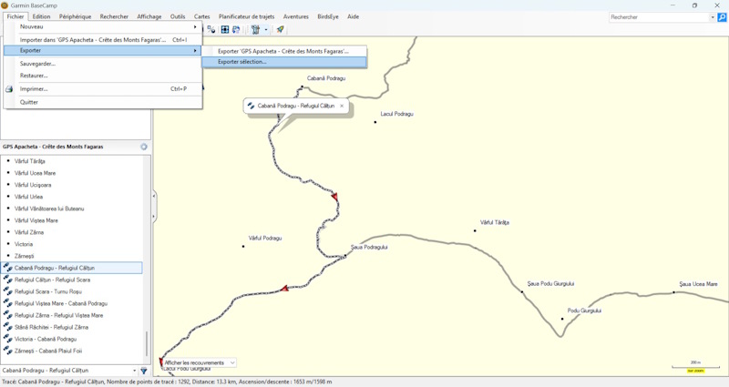
GPS watches and some basic GPS applications for mobile phones cannot read files containing multiple tracks. They only import the first track and then stop importing. In this case, you can use .GPX file editing software (e.g. Garmin BaseCamp) and open the .GPX file. Then save a file containing the waypoints, then one file per track. You then need to import the ten or so files you have created into your watch. In the case of a GPS application on a mobile phone, it is best to switch to one that is compatible.
Which GPS application should you choose?
It is preferable to use a mapping/GPS navigation application rather than an application for sharing tracks between users. The majority of the latter only record and share single-track files.
To help you choose, here is an article from I-Trekkings that compares 12 GPS applications. Here is a non-exhaustive list of applications that can read multi-track .GPX files:
- OsmAnd : A very comprehensive application with numerous features and settings, reserved for those who are proficient in its use.
- GPX Viewer : Intuitive, easy-to-use and effective application.
- Iphigénie : As it is the leading application in the UK, if you are accustomed to using it, it is best to stick with it.
- VisuGPX : Available as a mobile app and accessible on the web, it allows you to plan your route on a large screen.
Don’t forget to download the map backgrounds available in the app so that you can access them offline when you’re out on the trails without a connection!