Where can I buy hiking maps?
Who never knows how to break his head to find a good topographic map for his next trek at the end of the world? To do so, there are online bookshops that offer a large collection of hiking maps, travel guides, books… Among the most provided, there are (in France):
Here are the maps proposed by these libraries for the destinations covered by Guide Apacheta guidebooks:
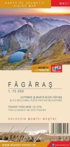 Făgăraş Mountains / Carpathian – Roumania
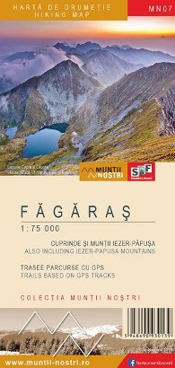
Numerous maps cover the Mountains Făgăraș at different scales. Among the most interesting maps, the collection Munții Noștri offers the most recent and updated maps of the Romanian Carpathians. It covers the massif with a double map referenced « Făgăraș MN07 ». The first one at 1:75 000 dedicated to the whole of the Mountains Făgăraș and the second one zoomed on the alpine area at 1:35 000. The map « Fagaras – Bucegi – Piatra Craiului » at 1:80 000, published by TerraQuest, also offers a good coverage of the massif, as well as the nearby massifs.
- Munții Noștri Făgăraș MN07 : Nostromo
- TerraQuest Fagaras – Bucegi – Piatra Craiului : Nostromo, La librairie du voyage, Cartovia
.
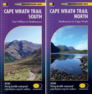 Cape Wrath Trail / Highlands – Scotland
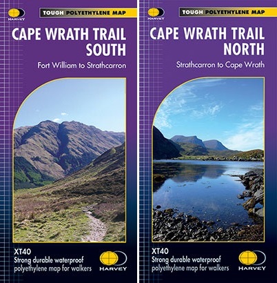
Several maps cover the Highlands at different scales. The publisher Harvey Maps offers two maps, « Cape Wrath Trail South » and « Cape Wrath Trail North » at 1:40 000, which cover the entire route and many variations. In addition, it indicates the quality of the trails (easy trail, unmarked trail…), various information and the maps are waterproof and tear-resistant.
- Harvey Maps Cape Wrath Trail North : Nostromo, La librairie du voyage, Cartovia
- Harvey Maps Cape Wrath Trail South : Nostromo, La librairie du voyage, Cartovia
.
Great Transcarpathian Trail / Carpathian – Ukraine
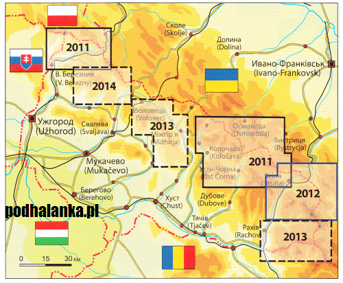
Crossing the Ukrainian Carpathians requires several maps, see this article for more details. Apart from the old maps of the Soviet army, which can be easily found on the internet, other more recent maps have emerged. Although they are harder to get hold of, they are easier to read and show trail markings. Since they are difficult to find, any map is good to take.
- Ukraine maps : Nostromo
.
Traumpfad the dream way / Tyrol & Dolomites – Austria & Italy
The Traumpfad does not currently have a single map of the entire route, so different maps are required. Several publishers cover the Eastern Alps in 1:25 000 and 1:50 000 scale. These are sufficient to complement the guide book and the GPS track..
For 1:25,000 mapping, you can purchase BEV maps from the Austrian publisher Freytag & Berndt and maps from the Italian publisher Tabacco :
- BEV 2223-Ost Hall in Tirol
- BEV 2229-Ost Brenner
- BEV 2230-West Hintertux
- Tabacco 037 Pfunderer Berge – Hochfeiler / Monti di Fundres – Gran Pilastro
- Tabacco 030 Brixen – Villnössertal / Bressanone – Val di Funes
- Tabacco 007 Alta Badia / Arabba – Marmolada
- Tabacco 015 Marmolada – Pelmo / Civetta – Moiazza
- Tabacco 025 Dolomiti di Zoldo / Cadorine e Agordine
- Tabacco 024 Prealpi e Dolomiti / Bellunesi
- BEV : difficult to find in France, alternative: Kompass 37
- Tabacoo : Nostromo, La librairie du voyage, Cartovia
For 1:50 000 mapping, the maps of the German publisher Kompass cover both countries:
- Kompass 34 Tuxer Alpen : Nostromo, Cartovia
- Kompass 82 Tauferer Ahrntal / Valli di Tures e Aurina : Nostromo, Cartovia
- Kompass 56 Brixen / Bressanone : Nostromo, Cartovia
- Kompass 59 Sellagruppe / Gruppo di Sella : Nostromo, Cartovia
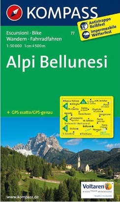
- Kompass 77 Alpi Bellunesi : is no longer published
Alternative : Kompass 672 is a set of four 1:36,000 maps that replaces maps 56, 59 and 77. The BEV maps can be replaced by Kompass 37 at 1:50,000, which covers the area between the Lizumer Hütte refuge and the border (the section between Innsbruck and Lizumer Hütte is therefore missing).
- Kompass 672 Dolomiten / Dolimiti : Nostromo, Cartovia
- Kompass 37 Zillertaler Alpen, Tuxer Alpen : Nostromo, Cartovia
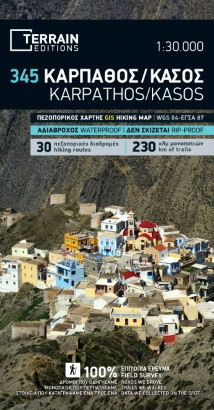
Great way of Karpathos Island / Aegean Sea – Greece
The island of Karpathos is covered by various maps that are easily available on the island or on the internet. The most precise and recent is the n°345 « Karpathos / Kasos – Κάρπαθος / Κάσος », published by Terrain Edition at 1:30 000. It covers the islands of Karpathos and Saria and contains a map of the city of Pigadia. All the paths are represented, as well as many other information such as churches, ruins, beaches… The map is also available in digital version with the ViewRanger application.
- Terrain Edition 345 Karpathos / Kasos – Κάρπαθος / Κάσος : Nostromo, La librairie du voyage, Cartovia
.
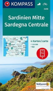 Gennargentu & Supramonte / Sardinia – Italy

The island of Sardinia does not have a wide choice of maps. The most suitable is no. 2498, entitled ‘Sardegna Centrale’. It is published at a scale of 1:50 000 by Kompass. The map covers the entire Gulf of Orosei and Gennargentu National Park. Unfortunately, there are errors in the layout of paths, tracks and trails. Sometimes a path is shown as a track, or sometimes it doesn’t actually exist.
The map is available online from the publisher’s website. If you have a paper version, you can download the map free of charge using the Kompass application.
- Kompass 2498 Sardegna Centrale : Nostromo, La librairie du voyage, Cartovia
.
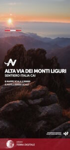 Alta Via dei Monti Liguri / Ligurian Alps & Ligurian Apennines
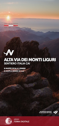
Italian publisher Terra Digitale offers a boxed set entitled “Alta Via dei Monti Liguri – Sentiero Italia CAI”. It comprises 4 double-sided 1:30 000 maps. This map set covers the entire itinerary, with the trail highlighted, stages and pictograms for accommodation.
Other Italian publishers cover the region, such as IGC – Istituto Geografico Centrale at 1:50 000 and Edizioni Multigraphic at 1:25 000. As the cut-outs are not specific to this itinerary, they each require a multitude of maps, or are old maps.
- Terra Digitale Alta Via dei Monti Liguri : Nostromo, Escursionista (in Italiy)
.
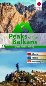 Peaks of the Balkans / Albanian Alps – Montenegro, Albania and Kosovo
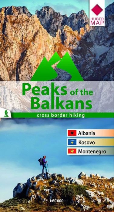
The Peaks of the Balkans tour is covered by the official map « Peaks of the Balkans » with a scale of 1:60 000 from Huber Verlag and the map « Prokletije / Durmitor, Albanian & Montenegro Alps » with a scale of 1:65 000 from TerraQuest. There are a few other maps that are a little more precise, but they only cover a more touristic area, usually Thethi and Valbona in Albania.
- Huber Verlag Peaks of the Balkans : Nostromo, La librairie du voyage, Cartovia
- TerraQuest Prokletije / Durmitor, Albanian & Montenegro Alps : Nostromo
.
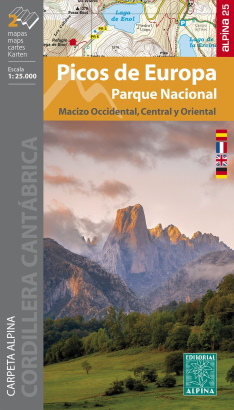 Tour of Picos de Europa / Cantabrian Moutains – Spain
The Picos de Europa mountain range is covered by a wide range of maps. The publisher Alpina offers a double map entitled “Picos de Europa Parque Nacional – Macizo Occidental, Central y Oriental” at 1:25 000. The first map covers the Western Massif, the second the Central and Eastern Massifs. It includes all the necessary information: marked and unmarked routes, refuges, water points, etc…
- Alpina Picos de Europa Parque Nacional – Macizo Occidental, Central y Oriental : Nostromo, Cartovia
- Alpina Picos de Europa Parque Nacional : Nostromo, Cartovia
.
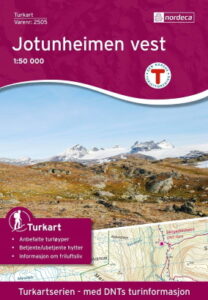 Tour of Jotunheimen / Scandinavian Alps – Norway
Two Nordic publishers cover the Jotunheimen National Park at 1:50 000 equally well. They are easily available locally or on the internet. The Norwegian publisher Nordeca has two maps, called “Jotunheimen aust” and “Jotunheimen vest”, and the Swedish publisher Calazo has a double-sided map, “Jotunheimen”. They also have maps of parts of the massif at 1:25 000.
The Norwegian trekking association DNT, Den Norsk Turistforeningen, offers on the portal UT.no and its associated application (only available in Norwegian), a trip planner with access to the country’s map, a multitude of information on trails, huts and more.
- Nordeca Jotunheimen vest : Nostromo, Cartovia
- Nordeca Jotunheimen aust : Nostromo, Cartovia
- Calazo Jotunheimen : Nostromo, Cartovia
.
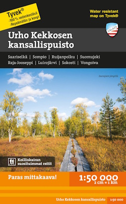
Urho Kekkonen National Park / Lapand – Finland
Two maps cover the entire Urho Kekkonen Nantional Park at a scale of 1:50 000, which can be easily obtained on site or on the internet: “Saariselkä Sokosti” Karttakeskus edition, “Urho Kekkosen kansallispuisto” Calazo edition. The Karttakeskus edition displays a little more place names and the Calazo edition has a slightly more legible contrast.
The Finnish Maastokartat map backgrounds are available online on many sites. The one of ExcursionMap.fi also allows you to display by superimposition a lot of information, such as the location of huts, shelters… Several GPS applications, such as Maastokartat, also offer these map backgrounds (free online consultation, paid offline download).
- Karttakeskus Saariselkä : now published by karttakauppa
- Calazo Urho Kekkosen kansallispuisto : Nostromo, Cartovia
.
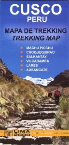 Inca cities of Vilcabamba / Andes – Peru
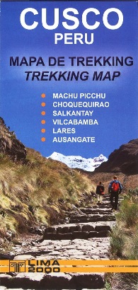
The Piki and Lima 2000 editions publish a booklet « Trekking Cusco » including six maps of the Cusco region, one of which is dedicated to the Vilcabamba Cordillera at 1:115 000. These are simple tourist maps (it is not a topographic map), with some mistakes, but sufficient to complement the Apacheta Guide to make a trek.
- Lima 2000 Trekking Cusco : Nostromo
.
Nahuel Huapi National Park / Patagonia – Argentina
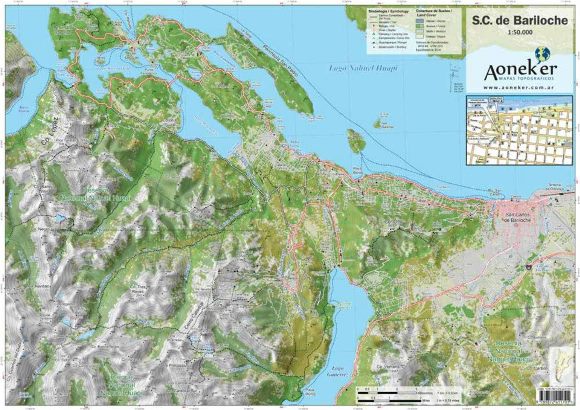
The Aonek’er editions have an excellent cartography covering the park in two 1:50 000 maps: « San Carlos de Bariloche » for the eastern part and « Monte Tronador – Paso de las Nubes » for the western part. Other editions cover the region in a single map, but they are less accurate « Refugios, Sendas y Picadas » at 1:100 000 and « Sendas y Bosques » at 1:200 000. Unfortunately these maps are not available in Europe.